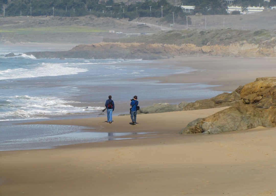
Pirin National Park represents Bulgaria's most dramatic mountain landscape, where marble peaks pierce the sky above glacial lakes and ancient pine forests. Designated as a UNESCO World Heritage site, this mountain range offers some of Europe's most challenging and rewarding trekking experiences. Stage 5 routes in Pirin demand excellent physical condition, mountain experience, and thorough preparation, but reward adventurous hikers with unparalleled natural beauty and genuine wilderness experiences.
Understanding Stage 5 Mountain Trekking
Stage 5 classification indicates advanced-level routes requiring significant mountain experience, excellent physical fitness, and technical skills. These routes typically involve multi-day expeditions through remote terrain, significant elevation changes, exposure to weather extremes, and sections requiring scrambling or basic climbing techniques. Unlike lower-level trails with frequent facilities and clear markings, Stage 5 routes demand self-sufficiency and navigation skills.
Pirin's Stage 5 routes traverse some of Bulgaria's most spectacular yet challenging terrain. Elevation changes often exceed 1000 meters in a single day, with trails climbing steep scree slopes, crossing exposed ridges, and navigating boulder fields. Weather conditions can change dramatically within hours, with summer snowstorms possible even in July and August at higher elevations.

The rewards match the challenges. Pirin's landscapes combine Alpine grandeur with unique Balkan character. Over 70 glacial lakes dot the high valleys, surrounded by endemic plant species found nowhere else on Earth. The marble peaks create otherworldly white landscapes contrasting sharply with the deep blue lakes and green pine forests below. Wildlife including chamois, brown bears, and golden eagles inhabit these mountains.
The Classic Koncheto Ridge Traverse
Koncheto Ridge stands as Pirin's most famous and challenging feature, a knife-edge ridge connecting Vihren Peak with Kutelo Peak at over 2700 meters elevation. The name translates as "the little horse," referring to the ridge's resemblance to a horse's back when viewed from certain angles. This exposed traverse represents the highlight of many Pirin expeditions and tests even experienced mountaineers.
The ridge extends for approximately 150 meters with dramatic drops of several hundred meters on both sides. Fixed cables provide handholds along the most exposed sections, but the traverse still requires steady nerves, sure footing, and absence of vertigo. Strong winds frequently rake the ridge, making timing crucial. Early morning starts before winds intensify provide the safest conditions.
Approaching Koncheto typically involves ascending Vihren, Bulgaria's second-highest peak at 2914 meters. The standard route from Vihren Hut follows a well-marked trail that steepens considerably in the final approach. The summit provides spectacular 360-degree views across Pirin and neighboring mountain ranges. From here, the traverse to Kutelo via Koncheto tests mental resolve as much as physical ability.
Successfully completing the Koncheto traverse delivers immense satisfaction and opens access to Pirin's remote northern sections. Descending from Kutelo, routes continue to Tevno Lake, one of Pirin's deepest and most beautiful glacial lakes. Mountain huts in this area provide overnight accommodation, allowing multi-day expeditions deeper into the range.
Multi-Day Circuit: The Pirin Traverse
The complete Pirin Traverse covers approximately 60 kilometers over 4-6 days, connecting the range's major peaks, glacial valleys, and mountain huts. This challenging circuit provides comprehensive experience of Pirin's diverse landscapes while requiring sustained physical effort and careful logistics. The route flexibility allows customization based on conditions, fitness levels, and time constraints.

A typical traverse begins in Bansko, following trails to Vihren Hut. Day one involves acclimatization hiking to nearby viewpoints while testing gear and assessing fitness levels. The second day tackles Vihren and the Koncheto traverse, descending to Tevno Lake Hut for overnight. Day three crosses high passes to reach the Bezbog area, passing multiple glacial lakes and traversing alpine meadows.
Subsequent days explore northern Pirin's granite landscapes, distinctly different from the marble southern sections. The northern area features more gradual terrain but extends further from civilization, requiring greater self-sufficiency. Routes pass through ancient Macedonian Pine forests, with some trees exceeding 500 years old. These ecosystems support unique flora and fauna, with careful route planning necessary to minimize environmental impact.
The final days descend back toward civilization, though options exist to extend treks into adjacent mountain ranges or loop back through different valleys. Total elevation gain across the complete traverse exceeds 5000 meters, with equivalent descent. Daily distances average 10-15 kilometers, though difficult terrain makes progress slower than lowland hiking.
Essential Preparation and Equipment
Stage 5 Pirin trekking demands thorough preparation beginning months before departure. Physical conditioning should include both cardiovascular endurance and leg strength training. Practice hikes with full pack weight on varied terrain help identify equipment issues and build necessary fitness. Altitude acclimatization matters less in Pirin than Himalayan ranges, but fitness for sustained steep climbing proves essential.
Equipment lists must balance completeness with weight considerations, as everything gets carried on your back. A quality four-season tent protects against unpredictable mountain weather, while a sleeping bag rated to at least minus five Celsius handles cold nights at altitude. Cooking equipment should be reliable and lightweight, with fuel calculations accounting for elevation effects on burning efficiency.
Navigation tools including detailed topographic maps, compass, and GPS device are mandatory. While major routes are marked, weather can obscure markings and trails can become indistinct. Mobile phone coverage is unreliable in mountain areas, so emergency communication should not depend on cellular networks. Personal locator beacons provide additional safety for truly remote sections.
Clothing must handle temperature ranges from below freezing to over 25 Celsius, sometimes within the same day. Layering systems using technical fabrics manage body temperature and moisture effectively. Waterproof and windproof outer layers protect against frequent afternoon storms. Quality hiking boots with ankle support and aggressive tread handle Pirin's rocky terrain, while approach shoes work for scrambling sections.
Safety equipment includes basic first aid supplies, emergency shelter, fire-starting materials, and water purification. Routes cross numerous streams and springs, but treatment is advisable. Mountain rescue services operate in Pirin, but response times in remote areas can extend to many hours. Travel insurance covering mountain rescue and evacuation is strongly recommended.
Mountain Huts and Accommodation
Pirin's mountain hut system provides crucial support for multi-day treks. These refuges, maintained by the Bulgarian Tourist Union, offer basic sleeping quarters, meals, and shelter during emergencies. Reservations are recommended during peak season, though most huts accommodate overflow in emergency situations. Hut spacing allows daily stages of reasonable length while providing shelter options.
Vihren Hut, one of the most popular, sits at 2000 meters elevation near the base of Vihren Peak. The facility includes dormitory accommodation, a restaurant serving hot meals, and supplies of basic provisions. Operating year-round, it serves as base camp for numerous summit attempts and through-hikes. The hut can accommodate over 100 people, though crowding occurs during peak weekends.
More remote huts like Tevno Lake Hut and Bezbog Hut offer similar facilities in more isolated settings. These locations provide true mountain atmosphere with fewer visitors and closer proximity to prime trekking routes. Facilities remain basic compared to Alpine huts, but clean dormitories, hot meals, and running water meet essential needs. Hut wardens often provide valuable local knowledge about conditions and route beta.
Wild camping is permitted in designated areas throughout Pirin National Park, offering greater route flexibility and solitude. Campers must follow Leave No Trace principles, camping only in established sites and carrying out all waste. Water sources are abundant in most areas, though purification remains necessary. Camping above tree line exposes tents to harsh weather, making quality equipment essential.
Seasonal Considerations and Weather Patterns
The primary trekking season in Pirin extends from late June through September, with July and August offering the most reliable weather. Even during summer, snow patches persist on shaded north-facing slopes and in high passes. Spring snowmelt makes many routes impassable until late June, while autumn snow can begin closing high routes by early October.

Summer weather patterns typically feature clear mornings with clouds building through midday and frequent afternoon thunderstorms. Starting hiking early allows reaching exposed ridges and summits before storms develop. Lightning poses serious danger on exposed ridges and peaks, making weather awareness crucial. Weather forecasts should be checked before departure and monitored throughout treks.
Temperature variations demand preparedness for extremes. Summer nights at altitude regularly drop below freezing, while daytime sun exposure at elevation can cause sunburn and heat stress. Wind chill significantly affects perceived temperature on exposed ridges. Layering systems and sun protection mitigate these challenges, but awareness and appropriate responses to changing conditions prove essential.
Shoulder seasons of late spring and early autumn offer advantages including fewer crowds and spectacular scenery, but come with increased weather uncertainty. Snow conditions in June can make some routes dangerous without proper equipment and skills. September brings beautiful fall colors but shorter days and increased storm potential. These periods suit experienced mountaineers comfortable with uncertain conditions.
Environmental Conservation and Trail Ethics
Pirin's UNESCO World Heritage status reflects its exceptional ecological value and creates responsibilities for visitors. The park protects endemic plant species, pristine glacial lakes, and old-growth forests that have survived for millennia. Modern trekking impacts, if not carefully managed, threaten these fragile ecosystems. Following established trails, camping only in designated areas, and practicing strict Leave No Trace principles protect this treasure.
Human waste disposal requires particular attention in mountain environments where decomposition proceeds slowly. Carrying out all toilet paper and using established facilities when available minimizes impact. Wild camping should occur at least 50 meters from water sources to prevent contamination. All trash must be packed out, including organic waste like fruit peels that attract wildlife and introduce non-native species.
Wildlife viewing opportunities abound in Pirin, but responsible observation maintains proper distance and avoids disturbing animals. Chamois are frequently spotted on high ridges, while marmots inhabit alpine meadows. Brown bears, though rarely seen, inhabit Pirin's forests, making proper food storage important. Photography should use appropriate lenses rather than approaching wildlife too closely.